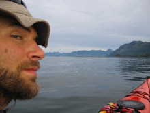
For those of you who have never been to Strathcona Park before, you are missing out. While many people know about the park, few venture past the parking lot or main hiking areas. Much of the backcountry routes are ridge line hikes that, as I found out, are very labourous and much much harder than the topographic map would imply. So, if you do go, be forewarned as you may be in for more than you bargined for.
One annoying thing about the park is that there is not much information readily available to hikers who want to venture into the backcountry. The only trail maps are a set of small pages out of the Hiking Trails III guidebook which are so hard to follow that they are virtually useless (the scale is small and you have no idea what a full route looks like since you can only see a small section at a time). Because of this, I made a huge effort to put together some custom maps using the NTS topographic series vector data along with hand digitizing all of the existing trails. It was a labourous process but the outcome was some really nice maps on size A2 paper.
The other annoying thing is that all of the information on times for trails is extremely conservative. We tried talking with various people about the terrain and timelines and we either go no answers, or again, very conservative estimates. I knew this but Kim, being much more concerned with timing and her ability, really thought that we would be in for a sufferfest on our vacation time. She really didn't want to be hiking for 14 hours a day and frankly, neither did I.
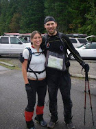
After much deliberation of picking a route in the park (I had a big long hike planned that really was way too ambious for the terrain) Kim and I decided on doing two separate loops that each ended close to the car and would allow us to resupply with food and thus, not carry as much. The first loop (and in the end the only loop we would do) was a ridge hike on Phillips Ridge, around to Marble Meadows, down to Buttle Lake, up to Mt Phillips, and down to the car. This would be around 55km with lots and lots of elevation (maybe around 4000 meters up and down).

We packed food for four days max but thought we might be out in three if the weather held. Kim and I had only done one trip in the past over in Olympic Pennisula National Park (which was amazing) and from that trip, I knew that I needed to take more gear to balance things out.
For all intent and purposes, going on a packing trip is much like being on an adventure racing team; you can only go as fast as a slower member and helping them out will only make everyone happier.
Not that we were trying to go as fast as we could but if I took more weight, it would slow me down, and keep Kim fresher and more comfortable over the duration of the trip. So, I ended up packing our camping mats, extra water, all the food, and all of the cooking supplies (stove, fuel, pots, cutlery, etc). As we went pretty light, my pack was still under 60 lbs and I think Kim got away with only 25 lbs. It was funny though, throughout the trip she kept trying to take some of the food or something to share the load as she felt guilty for not carrying more. She did cook all the meals which was great for me!
So, onto the trip. I won't go into much detail as the photos do a good job of what we were going through. The trip started with gorgeous hot weather.

We climbed up from the parking lot at the end of Buttle Lake Road (by the mine) up to Arnica Lake. It was during this section that we came upon a few other hikers who told us that it would take over 12 hours of hiking to get over to Schelderip Lake (which we estimated to be less than 8 hours). These guys seems fit and told us that the route was very tough going. This put a bit of a damper on our plans but it still didn't seem right to me that they were taking so long to move in the terrain. We continued on and arrived up at the lake in less than 2 1/2 hours (which was 3 1/2 hours faster than the estimated time!). We talked to more packers and they again explained there struggles and long time frames. I guess we would see what we could do.

From Arnica Lake, the trail moves up and up to 1600 m where you get panaramic views of the surrounding mountains and our route to come.
 Hiking above the tree line
 We decided to call an early day and found a piece of flat ground just big enough to fit the tent (after moving some rocks).

The views from the camp were incredible
 Hanging Clouds
 The next day we awoke to clouds and greyness. We knew that the weather was changing and there was a big low pressure system coming in but when you're on vacation for a limited time, what are you going to do? We kept going.

After leaving camp, we soon found that the terrain got much much harder. Flat areas on the map were constantly undulating; there were no flat sections on this hike. It was either up or down and much more than the topo map suggested. Nonetheless, we made it by Schelderip Lake in much less time than the other hikers and were starting to wonder what other people do and how much gear they must bring. Even then, it didn't really make sense. The only thing I could really think was that most people don't know how to hike. They move much too quickly, take lots of breaks, and fall apart from trying to push themselves too much. We were only going at a moderate but steady pace yet we were going 60% faster?!?!? I think Kim started to feel good about this :)
 Lots of snow up on the ridges

Despite the clouds, we were gifted with some great views
 The weather continued to worsen and by the time we got to the camp on Greig Ridge, we found our saviour; an aluminum framed canvas tent complete with chairs, kitchen counter, propane and a heater! The place was also stocked with some very warm down clothing which we used to temporarily get us nice and warm and dry. The camp was actually part of a Vancouver Island Marmot conservation project. While we had at least 3 hours of hiking time left to go, we decided that we should just hunker down due to the deteriorating weather. It was a very good plan as we faced lots of rain, snow, and what must have been gail force winds up on the ridge.
 The next day, we awoke to thick fog, rain and more wind. This photo was taken during a brief open period. As the route was trecherous enough when you could actually see, we figured it wouldn't be very smart to move especially into unexplored terrain. The weather never let up all day which meant hanging out, listening to a hand crank radio, reading some backpacking magazines, and doing some Sudoku; all courtesy of the camp.

The next day we were greeted with clear skies although you could tell that this wouldn't last for too too long. Here's our camp on the ridge.

As we were weathered for more than a day, our food supplies were getting low and we couldn't really risk getting weathered in again. Thus, we had to abandon our full route and head back the same way we came. In the beginning, I was a bit disappointed but it didn't last long as the way we came was pretty incredible and definitely worth a revisit.

The Golden Hinde finally peaking out; upper mid left

A very welcoming sun to the new day

Greig Ridge looking over to our destination, Phillips Ridge

A couple of Mt. Finlaysons to climb on the way back. And then a few more.

Our first big ridge summit and Mt. Burman in the background

Mount Burman with Schelderip Lake

Good geology riddled the hike

Rock intrusion

The clouds moving in on us once again

It was a good 11 hike out to the car including a good and long final stop at Arnica Lake to fuel up before the last descent. Instead of doing another loop, we decided to head up to Mount Washington and maybe do a trip into Mount Albert Edward instead. In the end, the weather wasn't great and we just ended up relaxing, trying to walk properly (Kim :) ), and watching a bunch of the Olympics.
While it wasn't an ideal trip, it was still pretty incredible and the loop deserves a second go in the future. Maybe next year.
TNO


 A zodiac ride to look for some background samples.